Dalton Highway (Alaska 11) Photo Journey - page 1
by Oscar Voss
Last expanded and updated May 2018
This is a revised and updated version of the original Dalton Highway
Photo Journey, which was co-authored and hosted by Andy Field. It was an adjunct to the Dalton Highway page of his former
site on High Priority Corridors (a few dozen highways deemed by Congress to be of special national importance and worthy of priority Federal support -- the Dalton Highway is High Priority Corridor 24).
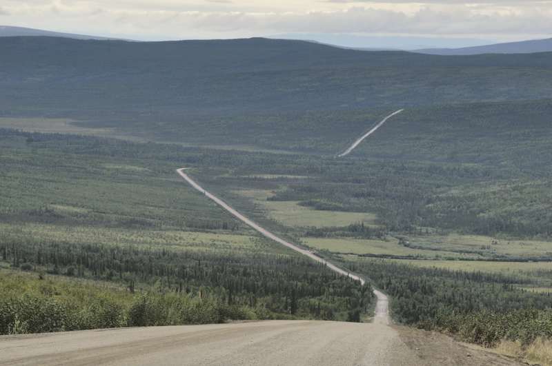
The largely unpaved 415-mile-long Dalton Highway runs
from Livengood (on Alaska state route 2 northwest of Fairbanks, about halfway
to Manley Hot Springs), through the Brooks Range, to Deadhorse and Prudhoe
Bay. Its gravel surfaces are notoriously rough on tires and windshields.
Built in haste in 1974 as the "haul road" for construction of the parallel
Trans-Alaska Pipeline, it remains a vital supply line to the oilfields
of Alaska's Arctic Coast. Long restricted to oilfield and pipeline
service vehicles, it is now open to the general public all the way to its
north end a few miles south of the Arctic Ocean. However, there is
almost no population along the way, and travel services are very limited. North of Coldfoot is the longest service-free stretch of highway in North America -- no gas, almost no food or lodging, no nothing (except awesome scenery) for 240 miles.
Unless otherwise indicated, the photos below are my own, and from
a van tour of the highway I took in suumer 1994. A few photos were taken on my return trip to Alaska in summer 2001 which included just the first few miles of the highway's southern end. More of my photos were taken on my July 2012 round-trip drive of the highway in my pickup truck. I've also added some photos from
Bob Hoffmann's Alaska Adventures collection (once online, but apparently no longer), the U.S. Bureau of Land Management, and many by Walter Haight from his August 2004 trip on the highway to the Arctic Ocean and back, to fill gaps in my collection.
If you have photos I can use, with appropriate credit, to fill other gaps, please e-mail me.
NOTES: If you want to see a more detailed version of one of the photos below, click it to view an enlarged, and sometimes higher-quality (less .jpg compression), version if one is available. Those alternate versions have much larger file sizes, so please be patient while they download.
This photo collection is divided into three pages. The photos below cover the southern end of the highway, from its beginning in Livengood to the Arctic Circle (mile 115). Page
2 covers the middle segment from the Arctic Circle to Atigun
Pass over the Brooks Range (mile 245). Page 3 completes
the journey north to the Arctic Ocean, and concludes with a list of reference sources and some other
Dalton Highway-related web sites.
|
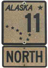
 This
is what the Dalton Highway's route shields look like. I think the elegant design, incorporating the Big Dipper and
the North Star from the state flag, makes Alaska's route shields among
the nicest in the U.S. (July 1994) This
is what the Dalton Highway's route shields look like. I think the elegant design, incorporating the Big Dipper and
the North Star from the state flag, makes Alaska's route shields among
the nicest in the U.S. (July 1994)
This route marker was at the southern end of the Dalton Highway. Others can be found near the Yukon River crossing (mile 56), Coldfoot (mile 175), Slope Mountain Camp (mile 305), and maybe the highway's north end in Deadhorse.
The Dalton Highway was long the highest-numbered route in Alaska,
until 2001 when the Klondike Highway from Skagway in southeast Alaska to
the Canadian border was designated as route 98 (for the gold rush of 1898).
|
 |
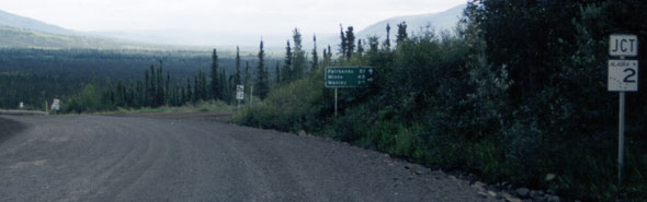 |
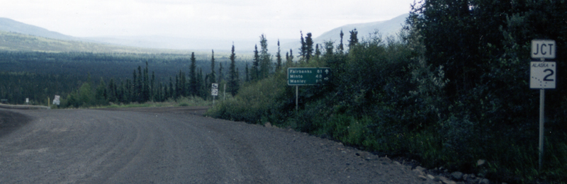
 This is the
south end of the Dalton Highway, facing southbound, where it joins the
Elliott Highway (Alaska state route 2) near Livengood. Most southbound
Dalton Highway traffic goes straight ahead onto the eastbound Elliott Highway
to Fairbanks. A right turn takes you west on the Elliott Highway,
to Manley Hot Springs. (June 2001) This is the
south end of the Dalton Highway, facing southbound, where it joins the
Elliott Highway (Alaska state route 2) near Livengood. Most southbound
Dalton Highway traffic goes straight ahead onto the eastbound Elliott Highway
to Fairbanks. A right turn takes you west on the Elliott Highway,
to Manley Hot Springs. (June 2001) |
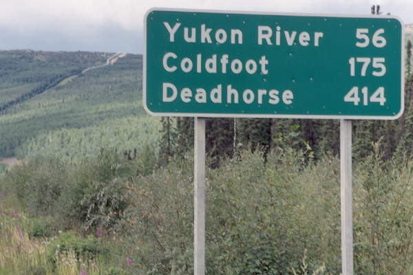
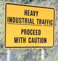
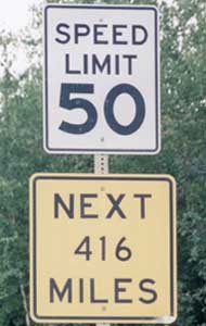
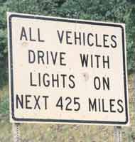
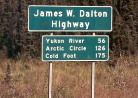
These three signs greet northbound
travelers at the south end of the Dalton Highway, to remind them of the
long, hard haul ahead. (All photos June 2001)
|
 |
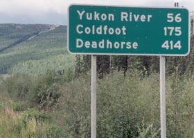 |
The distance
sign on the left at the beginning of the Dalton Highway is from my July 1994
vacation. (The highway is named for an engineer involved in early oil exploration
efforts on the North Slope.) By my return in June 2001, it was replaced by the
sign on the right (with the Trans-Alaska Pipeline, paralleling the highway,
in the background).
|
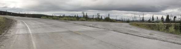 |
At mile 21.5, a paved highway segment peels away from an old unpaved alignment, now used as a parking area. (July 2012)
|
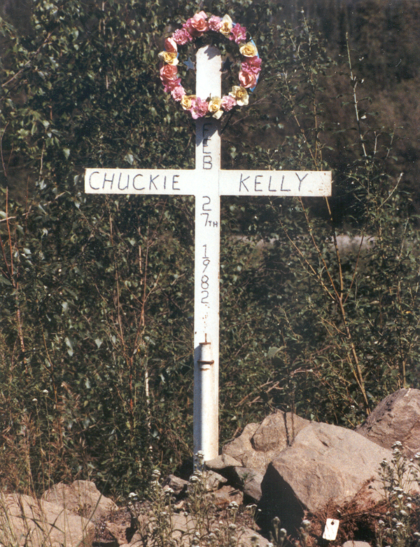
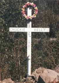
| A trucker drove his rig off the road here, somewhere south of the Yukon River (perhaps near mile 33). (July 1994) |
|
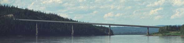 |
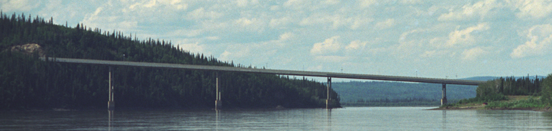
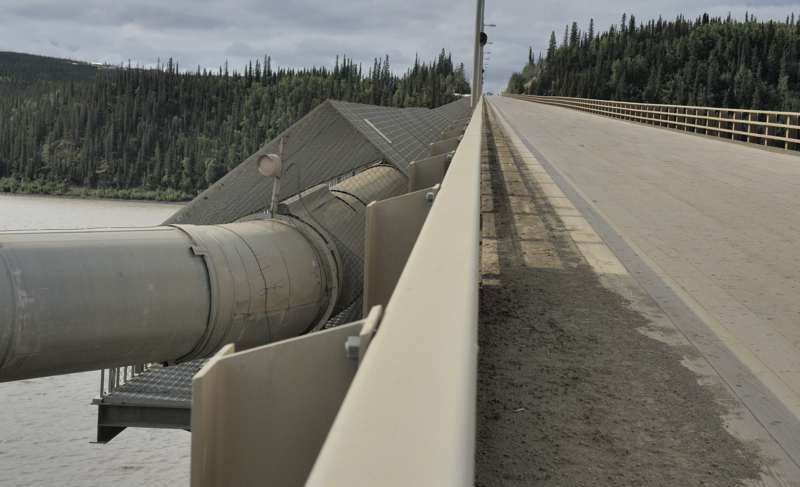
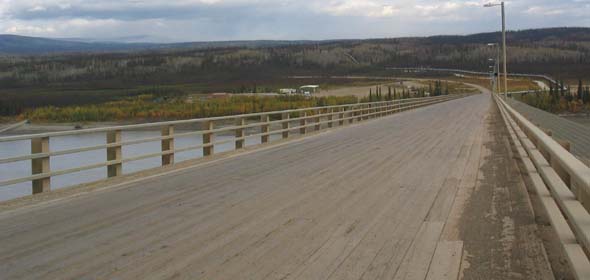
This highway bridge (photographed from a tour boat approaching from the east) crosses the Yukon River near mile 56. The bridge has a wooden deck and a 6% grade, and is about 2290 feet long. The bridge also carries the pipeline across the river. (July 1994)
|
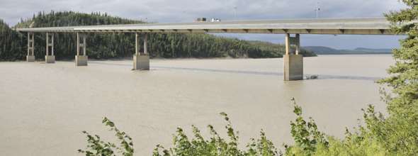 |
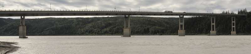
Another view of the bridge, from the shore northeast of the bridge, a short walk from the Bureau of Land Management visitor center. (July 2012)
|
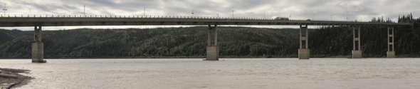 |
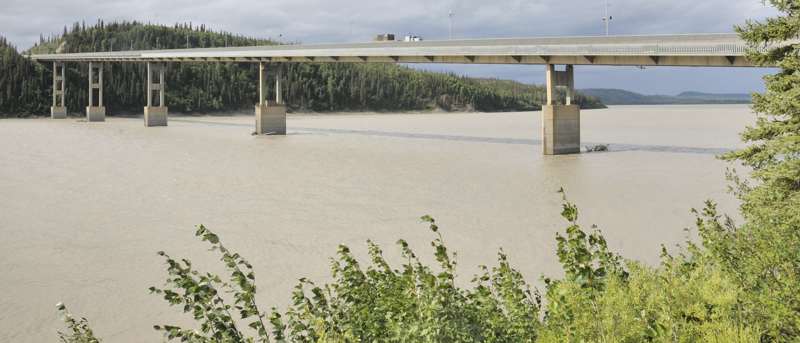
A third view of the bridge, from the barge landing northwest of the bridge. (July 2012)
|
 |
This northbound photo shows both the
Yukon River bridge's wooden deck, and the grille along the right side covering the pipeline. (August 2004, courtesy of Walter Haight)
|
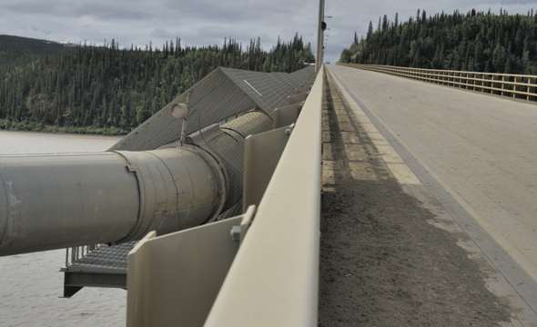 |
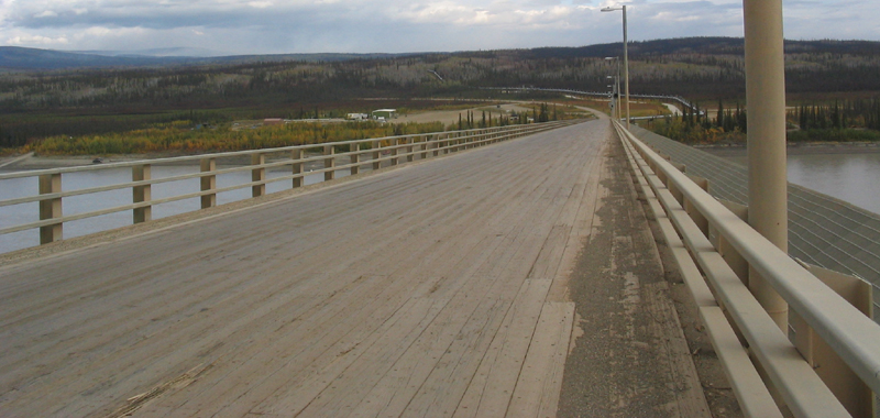
A southbound view of the wooden bridge deck, and the pipeline attached to the northbound side of the bridge. (July 2012)
|
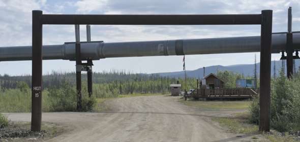 |
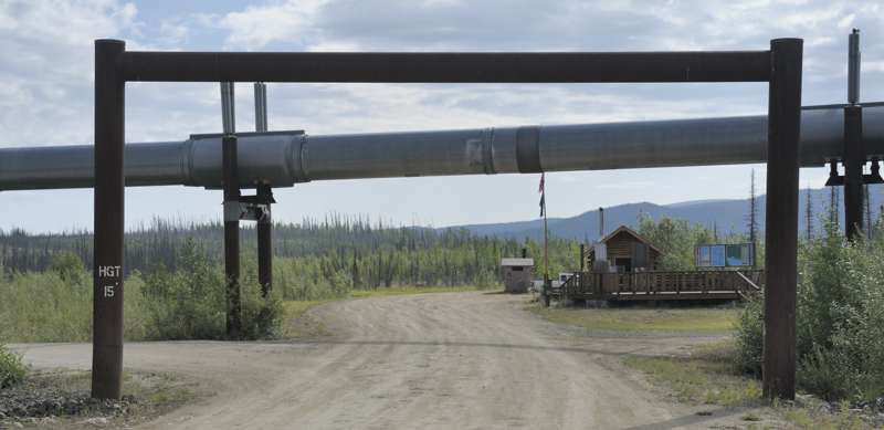
Immediately north of the bridge, side roads head west to the Yukon River Camp (truck stop with lodging), and east to a Bureau of Land Management visitor center. The east access road is open to the public, even though it passes under the pipeline. The "headache bar" between the highway and the pipeline blocks overheight vehicles that might damage the pipeline. (July 2012)
|
 |
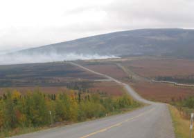
From mile 74.9, the south end of the "Roller Coaster", which combines a steep downhill grade with curves and undulating terrain to keep things interesting for truck drivers. (July 2012)
|
|
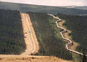
 This photo
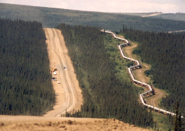
of the pipeline alongside the highway was taken somewhere north of the
Yukon River, probably near mile 90. The pipeline zigzags so it can shrink
and expand as temperature changes, and also flex during an earthquake,
without breaking. See page 2
for some closer views of the pipeline. (July 1994) This photo
of the pipeline alongside the highway was taken somewhere north of the
Yukon River, probably near mile 90. The pipeline zigzags so it can shrink
and expand as temperature changes, and also flex during an earthquake,
without breaking. See page 2
for some closer views of the pipeline. (July 1994)
|
 |
One of the recently-paved segments of the Dalton Highway, southbound near mile 106 north of the Kanuti River. As of 2018, about a quarter of the highway was paved, though as you'll see later old pavement seems to disintegrate as fast as new pavement is laid down. The elevated pipeline on the right (at this location, west of the highway) dives underground just north of the river, but stays underground south of the river to cross under the highway before re-emerging on the east side of the highway. These underground pipeline segments are sometimes at river crossings, but also to let wildlife cross over the pipeline (or the pipeline is elevated more than usual to help the critters cross underneath), or in an area where the hot oil in the pipeline won't melt permafrost under the pipeline. (August 2004, courtesy of Walter Haight)
|
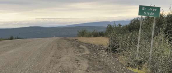 |
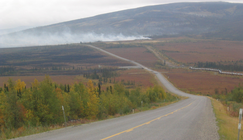
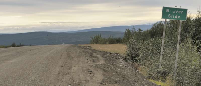
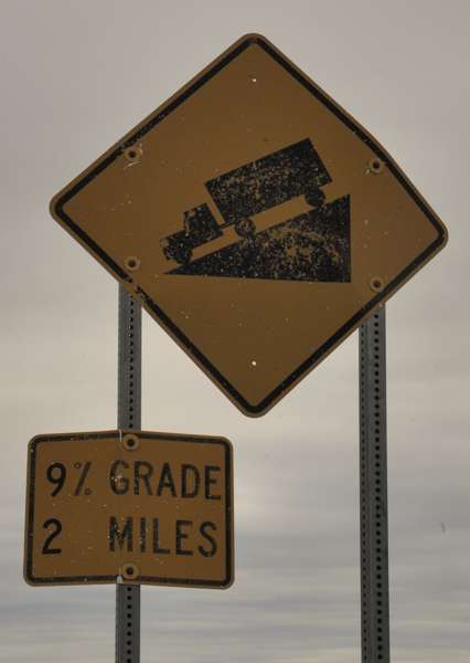
South end of the "Beaver Slide" highway segment and the nearby grade warning sign, at mile 109.8. (Both photos July 2012)
|

|
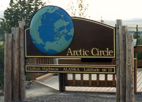 |
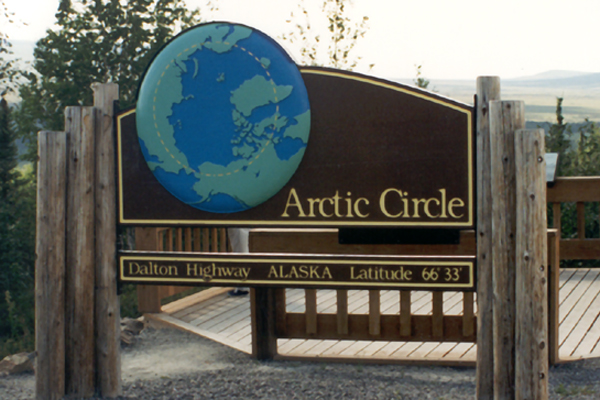
The turnoff to this Arctic
Circle sign is at mile 115.5. The Dalton Highway is the only highway in the
United States, and one of only two in North America, to cross the Arctic
Circle. (July 1994) |

(Page 2: Arctic Circle-Atigun Pass)
or go on to Page 3: Atigun Pass-Arctic Ocean, and links to related sites |
Alaska Roads main page (under construction as of May 2018, but has some useful information and links).
Questions, comments? Please e-mail me.
© Oscar Voss 1994, 2001-2002, 2004-2007. 2012, 2018. |