Dalton Highway (Alaska 11) Photo Journey - page 2
by Oscar Voss
Expanded and updated May 2018
This is the second page of a three-page photo collection on Alaska's
Dalton Highway to the Arctic Ocean. The photos below cover the highway north of the Arctic
Circle (mile 115), through Coldfoot (mile 175), to Atigun Pass (mile 245). Page
1 covers the southern end of the highway, from its beginning in Livengood
to the Arctic Circle (mile 115), and also provides introductory information
about the highway and this photo collection. Page 3 completes the
journey north from Atigun Pass to the Arctic Ocean, and concludes with a list of sources and
some other Dalton Highway web sites.
NOTE: If you want to see a more detailed version of one of the photos below, click it to view an enlarged, and sometimes higher-quality (less .jpg compression), version if one is available. Those alternate versions have much larger file sizes, so please be patient while they download.
|

(Page 1: introduction, and Livengood-Arctic Circle)
or go on to Page 3: Atigun Pass-Arctic Ocean, and links to related sites
|
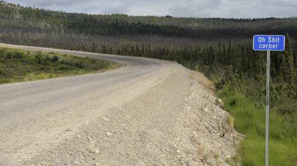 |
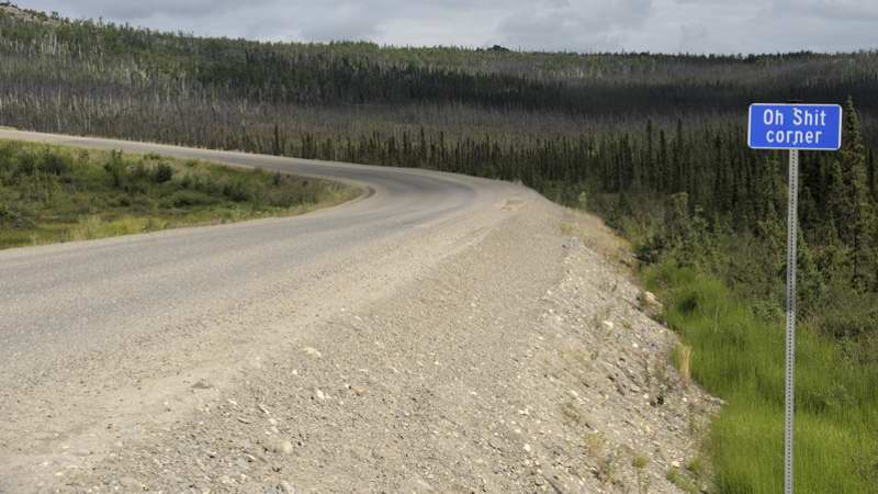
 This probably unofficial sign, near mile 126.5, marks a tricky turn where northbound truckers driving too fast down Paradise Hill often both literally and figuratively lose their loads. The 2012 edition of the Milepost mentioned the sign, but not earlier editions, while the 2013 and some later editions reported the sign was no longer there. So I guess I was lucky to catch the sign while it was still standing (timing is everything, huh?), as was the "Ice Road Truckers" TV series which in one episode showed a sanitized version of the sign. (July 2012) This probably unofficial sign, near mile 126.5, marks a tricky turn where northbound truckers driving too fast down Paradise Hill often both literally and figuratively lose their loads. The 2012 edition of the Milepost mentioned the sign, but not earlier editions, while the 2013 and some later editions reported the sign was no longer there. So I guess I was lucky to catch the sign while it was still standing (timing is everything, huh?), as was the "Ice Road Truckers" TV series which in one episode showed a sanitized version of the sign. (July 2012)
|
 |
 |
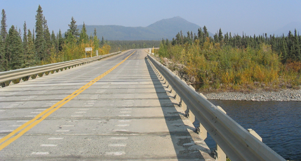
One of the three Jim River bridges, probably #3 at mile 144.1. (August 2004, courtesy of Walter Haight)
|
Another shot of the new pavement on the highway, this one northbound near mile 145. The pipeline, here fully-elevated, can be seen in the background on the right. (August 2004, courtesy of Walter Haight)
|
 |
 |
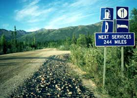
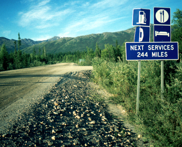
This old sign points travelers to Coldfoot at mile 175 (self-proclaimed "northernmost truck stop in the world"), and warns it will be a long way to the next place for full traveler services in Deadhorse just south of the Arctic Ocean. The sign has been replaced with a simpler services availability sign at the south entrance to Coldfoot, and a new warning sign at the north entrance (showing a slightly shorter distance to Deadhorse) shown below. (Photo by Dan Gullickson, courtesy of the U.S. Bureau of Land Management.)
|
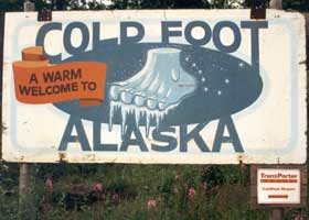
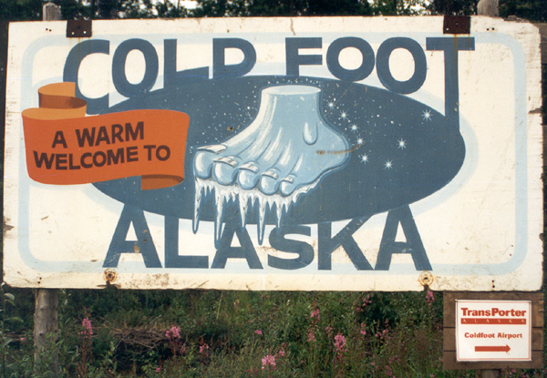
Coldfoot was
named for prospectors who got "cold feet" and fled after one of the area's
harsh winters. (July 1994) |
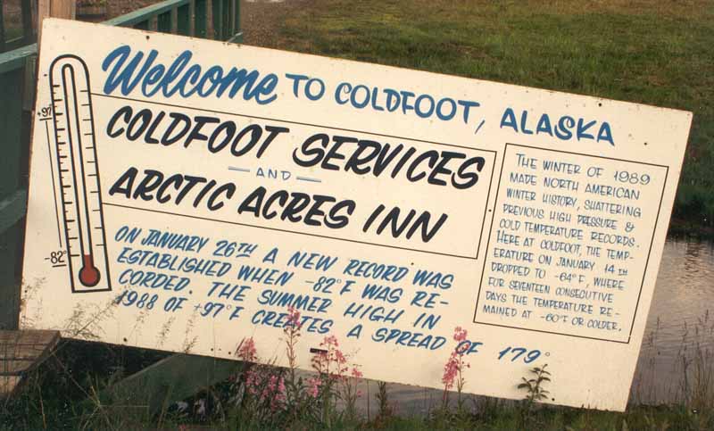 |
Another sign claims unofficial North American temperature
records, with an all-time low temperature of -82°F in January 1989,
followed by a high that summer of +97°F (a temperature swing of 179°F).
That January, Coldfoot reportedly went 17 days straight without the temperature
ever rising above -60°F. (July 1994).
|
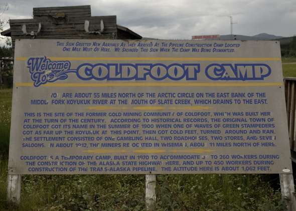 |
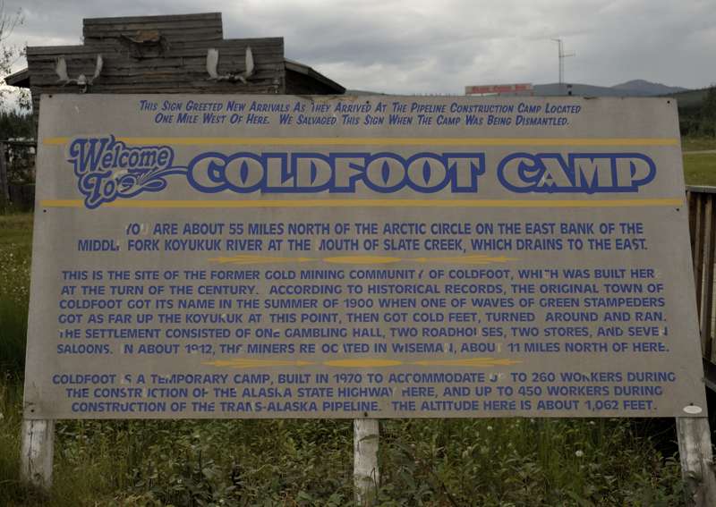
This sign covers the history of the Coldfoot pipeline and highway construction camp, which unlike many of the others along the highway lives on as a traveler service center, and the early 20th century gold mining camp that preceded it. (July 2012)
|
 |
|
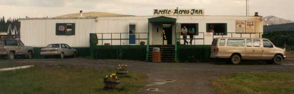
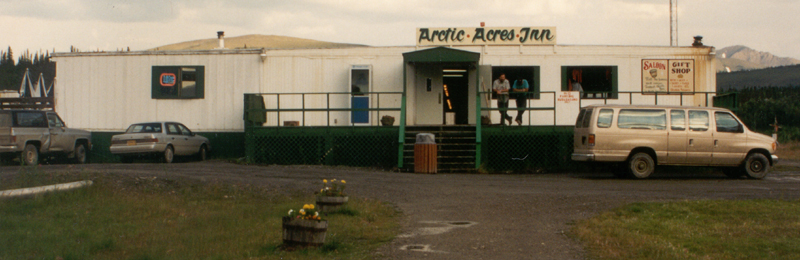
I stayed overnight in this converted pipeline construction camp, now called
the Slate Creek Inn, at $115 (in 1994) for a room barely large enough for
two people. Ouch! I stayed there again in July 2012, and paid $199, which happens to be the same rate charged by the other former construction camps along the highway (one at the Yukon River, the other in Deadhorse) offering overnight lodging to travelers. (July 1994)
The beige van parked in front of the inn is the one I rode in for my 1994 tour of the Dalton Highway.
|
 |
 |
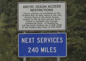
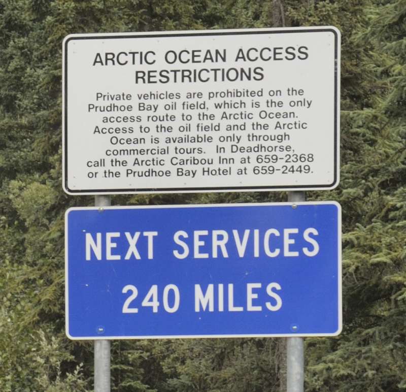
| This replacement for the Next Services 244 Miles sign above, at the southern entrance to Coldfoot, is just north of the northern entrance, with a corrected distance but still enough to scare anyone unwisely driving north past Coldfoot without refueling.
The top sign details some of the access rules for the Arctic Ocean beachfront in Prudhoe Bay. In particular, you need to use a commercial tour company, and make arrangements for that through one of the hotels in Deadhorse (while the Deadhorse Camp hotel isn't listed on the sign, you can make arrangements through it as well, which I did when I made reservations there). Not mentioned on the sign is that you need to make tour reservations at least 24 hours in advance, and provide a driver's license or other government ID number, so the oil companies can run a background check on you (can't let Commie saboteurs travel through their oilfields on the way to the beach, y'know). (July 2012)
|
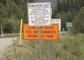
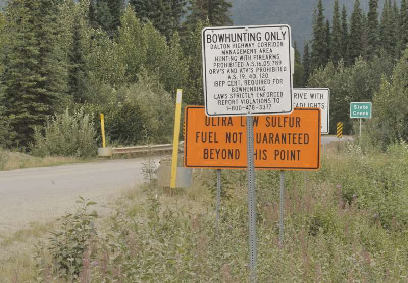
Alongside the next services sign is a reminder (also posted elsewhere on the highway) that hunters are not allowed to use firearms along the highway, and instead are restricted to bow and arrow. This is to help keep hunters from perforating the pipeline.
There is also a warning about diesel fuel availability in Deadhorse. That might've been temporary, and the sign may no longer be there. (July 2012)
|
|
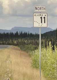
 This AK 11 marker, northbound just north of Coldfoot, is one of the few anywhere on the highway. One side effect of hunters being restricted to bow hunting, is that they don't use the marker for target practice. (July 2012) This AK 11 marker, northbound just north of Coldfoot, is one of the few anywhere on the highway. One side effect of hunters being restricted to bow hunting, is that they don't use the marker for target practice. (July 2012) |
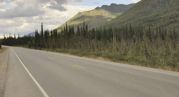 |
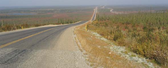
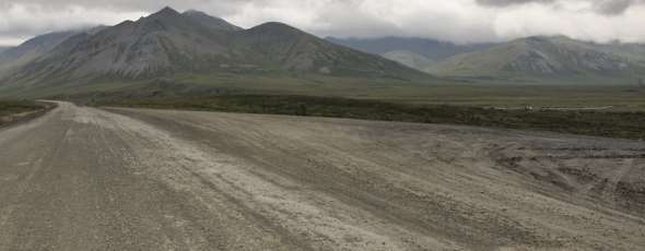
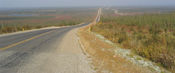
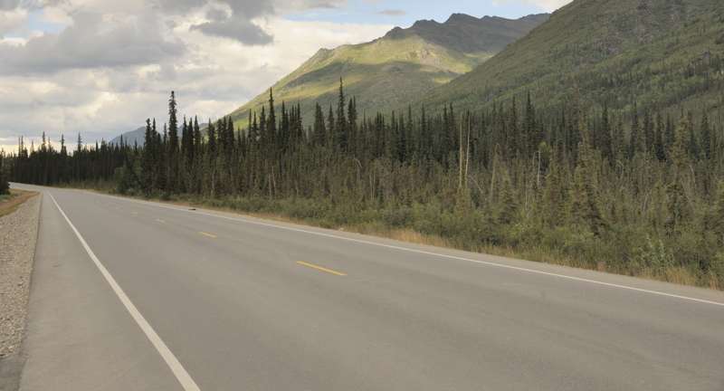
A scenic view with relatively new pavement, northbound at mile 181.5. Pavement damage was already beginning, including a half-dozen dips and one short gravel break, about a year after the 21 miles of new pavement north of Coldfoot was laid down. (July 2012)
|
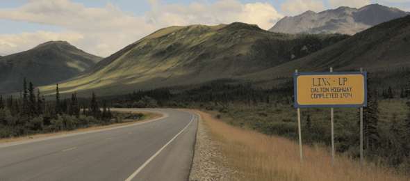 |
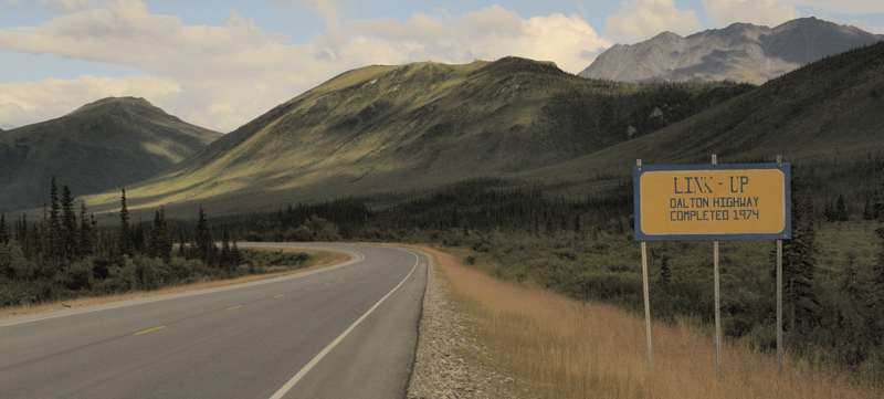
At mile 197.2, the Link-Up sign marks where the Dalton Highway was completed in 1974, as two construction crews approaching from opposite directions met. (July 2012)
|
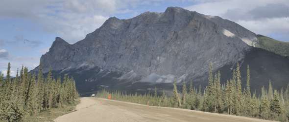 |
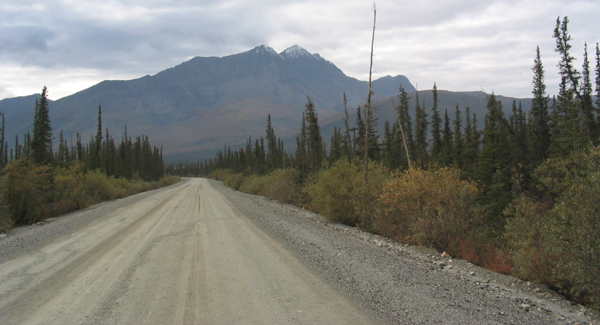
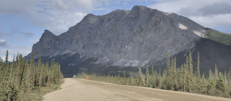
A scenic view, probably northbound near mile 202, of Sukakpak Mountain ahead and east of the highway. The highway reportedly is now paved at this point, to around mile 209. (July 2012)
|
_DSC4814.jpg) |
Another scenic view, this one southbound near mile 206, of the mostly limestone Dillon Mountain ahead and east of the highway. (July 2012)
|
 |
Until 1994, when the Dalton Highway was opened to the general public north of here to its end in Deadhorse, the former Disaster Creek checkpoint at this large turnout at mile 210.9 forced non-permit-holders to turn back south. (July 2012)
|
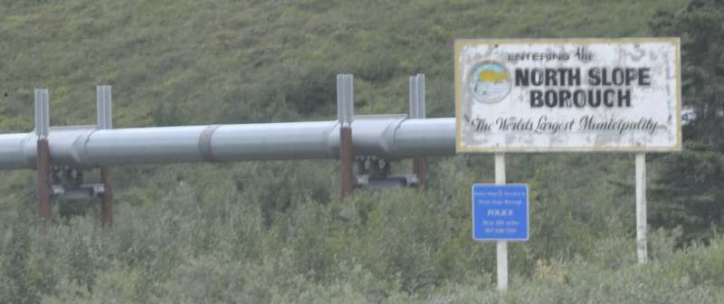 |
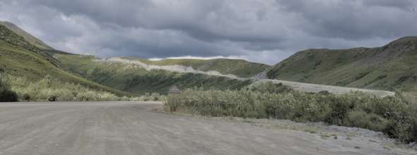
| Just before mile 235, south of the Brooks Range, is the southern boundary of the North Slope Borough. The sign says it is the "world's largest municipality" (88,817 square miles, larger than most states and many countries, but population
is under 10,000; borough seat is in Barrow, about 450 miles away, with no road access).
On the pipeline behind the sign, the radiating fins on top of the stilts are part of a passive "heat pipe" system, using ammonia refrigerant to keep the pipeline's hot oil from melting the permafrost under the stilts. Also shown are the sliding "shoes" on which the pipeline rides the transverse support beams, so it can shift laterally such as to adjust to emperature changes. (July 2012)
|
 |
 |
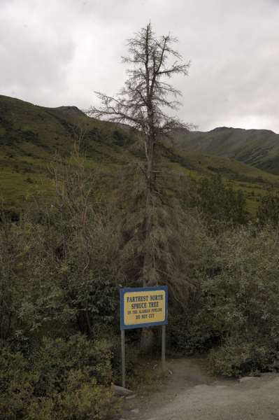
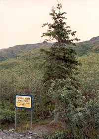
| Just north of mile 235, the sign says "Farthest North Spruce Tree on the Alaskan Pipeline -- Do Not Cut." Even at the lower altitudes of the coastal plain north of the Brooks Range, the weather and soil are very tree-unfriendly. In particular,
with permafrost (ground frozen solid all year long) as close as a foot beneath the surface, there's hardly any room for tree roots to grow.
This spruce tree was once in good shape, as shown in the photo above left. Alas, the tree was vandalized in August 2005. It still stands, but no longer lives, as shown in the photo
above right. The Milepost reports that the dead tree has since been removed, and stored at the Coldfoot visitor center. (Photo above left July 1994; photo above right July 2012)
|
|
The southbound highway, near the "Northernmost Spruce Tree" pullout. (August 2004, courtesy of Walter Haight)
|
 |
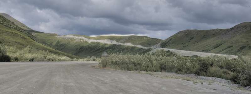
At mile 235.4, a large pullout just north of the "Northernmost Spruce Tree" site offers this view of the start of a two-mile-long, 10% grade climb up to the Chandalar Shelf. The Shelf is not as high as Atigun Pass farther to the north, but still is above the tree line at this latitude, so spruce or other trees don't stand a chance. (July 2012)
|
 |
 |
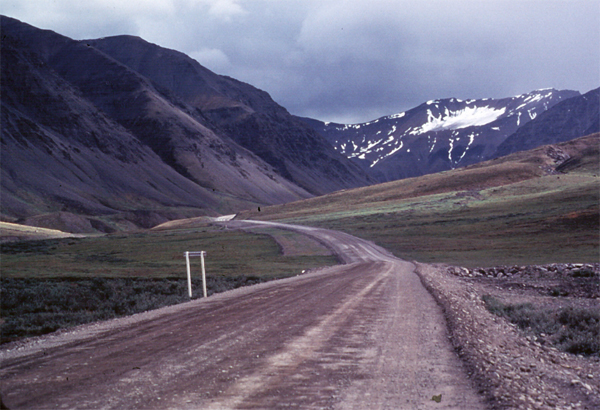
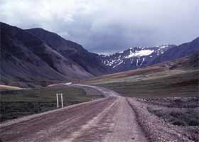
These two photos show the highway as it passes north toward Atigun Pass through the Brooks Range. The photo above left, near the old Chandalar pipeline construction camp at about mile 239, is courtesy of the U.S. Bureau of Land Management. The photo above right at mile 242.2, the foot of the long, steep 12% grade immediately south of Atigun Pass, is courtesy of Bob Hoffmann, taken June 1999, from his Alaska Adventure collection.
|
 |
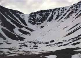 |
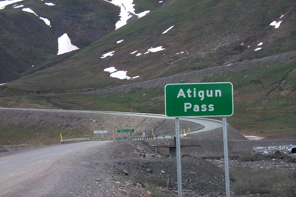
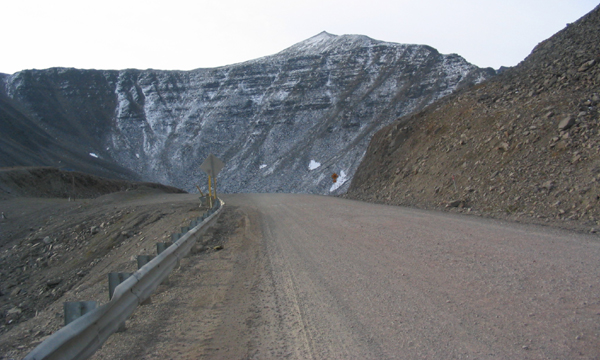
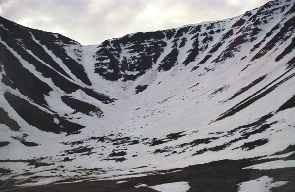
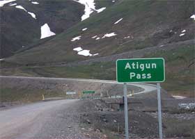
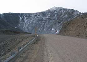
Atigun Pass, at mile 244.7. This is where the
highway tops out at about 4800 feet, the highest road pass in Alaska. The photo above left shows the highway at the summit. The photo above right shows a cirque (amphitheater-shaped bowl, carved out of the mountains by glaciers), alongside the highway at the pass. (Photo above left August 2004, courtesy of Walter Haight; photo above right July 1994) |

(Page 3: Atigun Pass-Arctic Ocean, and links to related sites)
or go back to Page 1: Livengood-Arctic Circle |
Alaska Roads main page (under construction as of May 2018, but has some useful information and links).
Questions, comments? Please e-mail me.
© Oscar Voss 1994, 2001-2002, 2004, 2006-2008, 2012, 2018. |

-large_DSC4814.jpg)